How do we define where an urban space is, what its edges are, without making those edges into barriers? That is one of city planners’ problems that we explored in our first field trip for my land use principles class, led by our instructor Katherine Nelson through the Central Business District of Silver Spring, We were joined by Reemberto Rodríguez, Director of the Silver Spring Regional Center, who proved to be a government executive blessed with equal parts of pragmatism, sardonic wit, and visionary enthusiasm. For Rodríguez, Silver Spring in all its diversity “is America”—nay, it is “the center of the universe.”
 Silver Spring’s CBD, designated by the state as an arts and entertainment district, has seen a massive amount of redevelopment in the past decade, and for the most part that redevelopment has been successful. But there are many projects in the planners’ books that are still empty lots, like this block scheduled for high-density housing just north of the new civic building at Veterans Plaza. The gradual relocation of light industrial businesses and low-density in the Fenton Village and Ripley districts, to be replaced with intensive development with FARs around 4, is also yet to come.
 Preservation of Silver Spring’s historic heritage, in whole or metonymically, was another theme of our walk. While the entire Silver Spring post office and a (currently rundown) tile-roofed building that was the birthplace of dry cleaning are protected complete, it is only the facades of the Silver Spring Shopping Center and Canada Dry bottling plant that have been retained.
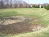
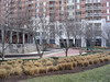
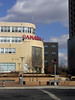
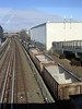 Pathways (narrow and broad) and open space are always fruitful topics of analysis when it comes to a place like downtown Silver Spring, situated as it is at the conjunction of three major arterials (Maryland 410, East-West Highway; U.S. 29, Colesville Road; and Maryland 97, Georgia Avenue), a passenger and freight rail line, Metro’s Red Line, and the future light-rail Purple Line. We looked at mandated public use spaces that worked, like a sliver of land attached to a condo block on Fenton Street (occupied by two residents even on this blustery cold February day), and a gateway space for the National Oceanic and Atmospheric Administration; and those that were less successful, like the fenced and gated garden at Discovery Communications. I’ve walked that block of Wayne Avenue many times and I wasn’t aware that the space in front of the building was open to the public.
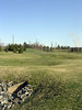
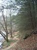
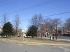 Honest-to-Fox green space, at present, is mostly pushed to the margins of the CBD, like Jesup Blair Park and this forlorn bit of space along Fenton Street. Jesup Blair was deserted on this unfriendly Saturday, but the soccer fields showed evidence of heavy use.
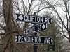
 Katherine led us down down several alleys along the walk, cutting across the twisted grain of the street grid, where the strong diagonals of the District line and railroad contend with the natural inclination of north-to-south. Numerous signs directed us to nearby bike paths that didn’t quite penetrate the CBD’s core. We looked at the edge-and-barrier problem along Cedar Street, where single-family homes are converted by special exception to light office uses like lawyers and clinics, and cut-through vehicle traffic is inhibited by turn restrictions.
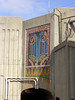 Both Katherine and Reemberto pointed out the strength of small design details and amenities: a newly-built sidewalk bulb-out at Georgia and Bonifant, the banners (for money reasons, no longer maintained) that once identified the district, some distinctive brick and metalwork along Fenton Street. I noticed the mosaic and mural Silver Pass, a valiant effort to dress up the pedestrian underpass (all right, tunnel) that carries walkers along Georgia Avenue under the rail tracks.
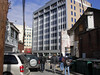
And along East-West Highway, we even found, in a somewhat shabby state, the original Silver Spring. Not to mention the cryptically named Roger Miller Restaurant.
I came away from the field trip, a visit to an area that I thought I knew well, with a generous handful of places to come back and explore fully: the scrappy new Bonifant Theatre Space, the historical society in the original train depot, jazz at Vicino, the shiny performing arts venue at Montgomery College, Silver Spring Books (also on Bonifant).
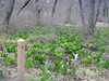
 Mayapple (Podophyllum peltatum) has begun blooming, or at least it has at Governor Bridge Natural Area in Prince George’s County, south of Bowie. I made the acquaintance of two exquisitely tiny blue flowers, the five-petalled Smaller Forget-Me-Not (Myosotis laxa) and the four-petalled Bluets (Houstonia caerulea), also known as Quaker Ladies.
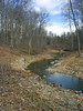
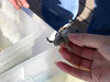
 Down along the river trail, we had side-by-side looks at Solomon’s Seal (left) and Solomon’s Plume (right). Solomon’s Seal (Polygonatum sp.) has a gently arching stem, smoothly curved, while the stem of Solomon’s Plume (Maianthemum racemosum) shows sort of a zigzag effect.