Memed: 1

Via Birderblog.com, the The Hawk Owl’s Nest is conducting a survey:

  • What state (or country) do you live in? Virginia
  • How long have you been birding? 13 years or so
  • Are you a “lister”? Yes
  • ABA Life List: 338
  • Overall Life List: 338, which is also my Lower 48 list total.
  • Favorite Birding Spot: Huntley Meadows Park, Fairfax County, Virginia.
  • Favorite birding spot outside your home country: none yet
  • Farthest you’ve traveled to chase a rare bird: about an hour for a Pomarine Jaeger that had wandered far inland into Loudoun County, Virginia.
  • Nemesis bird: Florida Scrub-Jay
  • “Best” bird sighting: A lifer: American Dipper in Eldorado National Forest on Christmas Day, just after the snows had melted sufficiently to make the roads passable.
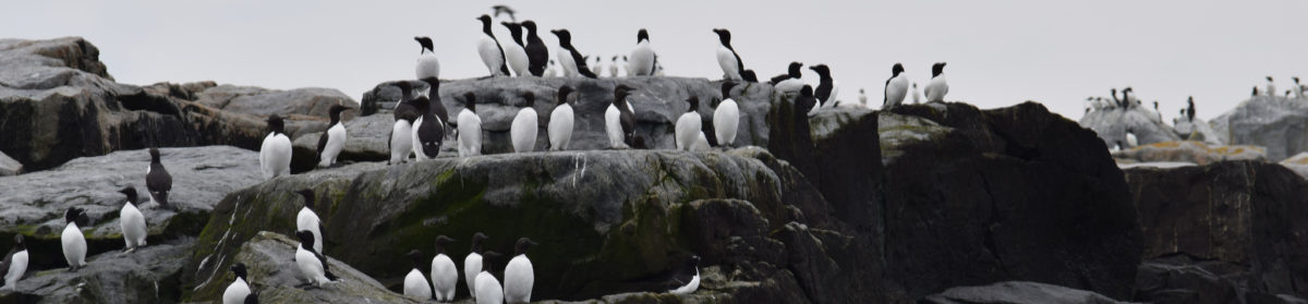
  • Most wanted trip: Maine and the Maritimes
  • Most wanted bird: Atlantic Puffin
  • What model and brand of bins do you use?: A somewhat beat-up porro prism Celestron 9.5 x 44
  • What model and brand of scope do you use?: Kowa TSN-1
  • What was the last lifer you added to your list?: Piping Plover near Oregon Inlet, North Carolina. I never would have noticed the flock of seven birds on a wind-whipped flat if I hadn’t stumbled upon a pair of field researchers who were tracking them with radio.
  • Where did you see your last lifer?: see above
  • What’s the last bird you saw today?: Alas, I think the last bird I noticed was a Fish Crow at dusk yesterday.
  • Best bird song you’ve heard ever: Wood Thrush, in the backyard of my suburban, habitat-fragmenting townhouse.
  • Favorite birding moments: A visit to the Powdermill banding station in Pennsylvania. My first trip to the Outer Banks of North Carolina (“My god, it’s full of birds!”). Seeing two lifers in my bins at the same time in a park in Sacramento. On a work-related training trip to Orange County, getting up early to drive down to the beach, then patiently keying out a California Gull for #300.
  • Least favorite thing about birding: High winds.
  • Favorite thing about birding: Using it as an excuse to vacation somewhere I’ve never been before.
  • Favorite field guide for the US: Peterson
  • Favorite non-field guide bird book: Proctor and Lynch, “Manual of Ornithology”
  • Who is your birder icon?: Let me get back to you on that one.
  • Do you have a bird feeder(s)? No. I don’t enjoy feeding squirrels.
  • Favorite feeder bird? White-Breasted Nuthatch

At the Park: 1

We went out for a short morning to work on the nest boxes at the Park. Since we forgot to bring a drill so that we could mount new boxes, all we accomplished was tearing down box 60. This wasn’t too hard to do, even without tools, because 60 was pretty ramshackle.

Paul spotted a couple of tail-bobbing Palm Warblers (Dedroica palmarum) and there were some lingering phoebes and swallows over the wetland. Or should we say, soon-not-to-be-wetland: lots of grassy vegetation and small willows and maples are springing up along the boardwalk.

slime moldI found several silvery masses of a slime mold in a rotting tree down along Barnyard Run. The lowest such mass (in the image) was a few feet over my head, about the size of my fist.


Old Rag

Sometimes it’s good to find out what you really can’t do any more.

The only other time that I’d hiked the Ridge Trail to Old Rag, that craggy outlier of the Blue Ridge in the eastern reaches of Shenandoah National Park, was August, 1992. Back then, the only notation I made in my logbook was my time to complete the 7.1-mile circuit from the upper parking lot: 4-1/2 hours. Now, I remember from that hike that it was a little tricky, and I particularly remember the section where you have to billy goat-hop from one boulder to another. I think it was foggy, and I went on a weekday when there wasn’t much traffic. What I found this past Sunday when I repeated the hike, was a lot harder than I remember. I almost wish that the ranger at the check-in station had told me, “This trail is not for you, out-of-shape middle-aged guy.”

on the way upLet me back up a bit. Old Rag is one of better-known mountains to hike in this part of the country. The north face is a ragged mess of tanker-sized boulders, and the upper reaches of the Ridge Trail are more the idea of a trail than a real trail, at least compared to what we day hikers in the East deal with. Or, as the concrete signpost at the Byrds Nest Shelter says, with unaccustomed albeit understated frankness, “RIDGE TR. IS VERY STEEP AND ROCKY.”

The first half of the climb, about 1000 feet, is not particularly arduous, just a steady climb through the usual Blue Ridge woods, with a smattering of mountain laurel. The biggest hazard you face, at this season, is the steady pelting of falling acorns. After that, things start to get a little crazy. There are three or four narrow, deep cracks that you have to negotiate. Then, at one point, the trail blaze, instead of the usual inch-and-a-half bars of friendly blue paint, is an arrow pointing straight down. I’ve lost a little agility and flexibility in my legs, and I’ve never had any upper-body strength to work with. I’ve made up for it with stronger claustrophobia. As I worked through the first crack, I experienced a twinge of panic, and once I got out of it, I felt the second twinge, when I realized that I could only go up—I was not going back down through that again. Ever.

When I got to the ledge, and couldn’t get over it the first time, I honestly wanted to cry like a little kid, “I cannot do this.” See, there was this ledge, about waist high, that you have to get up onto to continue on the trail. It’s in a crack about four feet wide, and blocked by a pointy stone jutting out about shoulder height. Probably what I did 14 years ago was chimney-walk the wall and jump over, but by this time I was already running at 80% and I didn’t trust my legs. So I pulled myself up on the jutting-out stone and slung myself over. Maybe it was easier the first time with new boots and no mud. Halfway up, I sincerely hoped that I wasn’t going to twist a knee.

under the rockI think I reached the first of the false summits shortly thereafter. After that, I didn’t so much mind the mini-tunnel that makes you drop to your knees, or the nasty joke of a boulder wedged above the trail made of steps cut into the rock. When I got to the boulder-hopping section, I sort of crawled up the boulders on my knees. I just kept working it, maybe three minutes on, three minutes off to get my breathing and anxiety back under control. I stopped for some food, but the lunch I brought, some poor choices, just sucked the moisture out of my mouth.

from the topI did indeed make it to the top of that G.D. mountain, three hours after leaving the parking lot. The views are fine up there, but the thing with me is that I usually enjoy the process, the climbing, more than I enjoy the summit. I took a picture for three guys hiking together, and I surprised myself by joking with them about the swarm of gnats that rests on the uppermost rocks, waiting for a foolish human to climb up.

trail junctionGoing back down, the Saddle Trail is a lot easier to take. It would be one of the more severe climbs of the Blue Ridge trails, but it’s still doable. Oddly enough, the Weakley Hollow Fire Road, which connects the Saddle Trail to the parking areas in a long gentle downgrade, is perhaps the smoothest, best-maintained fire roads in the Park that I’ve ever hiked. I had a brief “Big Two-Hearted River” splash in the cold waters of Brokenback Run, a tributary of Hughes RIver.

My time wasn’t too bad: from the lower parking area, which added about 40 minutes to the hike, I made the 9.4-mile loop (2300 feet of elevation change), in 5:40. But I think that’s my last time over the Ridge Trail.

In Martinsburg

Saturday morning I spent drinking coffee and reading a not-great short story anthology by a well-known American novelist, early-career efforts that were solidly mediocre, while I sat on Audrey and Charlie’s deck, listening to their neighbor running a backhoe across the top of the next ridge, scraping the pasture into what will become lawn. Along with the mockingbirds disputing territory and the goldfinches singing just to be singing, I watched a pair of Ruby-Throated Hummingbirds (Archilochus colubris) visit Audrey’s sugar-water feeder. The feeder was close enough that I could hear the buzz of wings as the birds hovered. And I heard something new, as a bird decided to perch up, the better to slurp artificial nectar: small chip notes, like tiny sneakers on a basketball court.

Four Mile Run Trail

This afternoon I finished my traversal (on foot) of the short but interesting Four Mile Run Trail. The trail is one of two connections for cyclists looking to get from the Mount Vernon Trail along the Potomac to the Washington & Old Dominion Trail to Purcellville.

The path covers widely variable territory along its 7.5-mile length. The trailhead is in the neighborhood of the East Falls Church Metro station. In this stretch of Arlington, the trail serves to connect several county parks: ball fields and back yards. Although it’s very pleasant here, the trail can be hard to follow, because it intertwines with the W&OD as both trails cross and recross Four Mile Run, a rocky stream at this point—and the signage is inconsistent. Distance markers were once set every half mile, but a couple of them are missing. At points the trail is no wider nor any more level than a hiking trail, and this serves to divert bike traffic to the much busier W&OD.

At about mile 5, there is a complicated diversion onto city streets at Shirlington to take you to the overpass that spans an interchange of I-395 (the Shirley Highway), the multilane transitway that connects the heart of the city to all the suburbs to the south. Beyond that, the trail follows streets around the cozy brick community of Parkfairfax in Alexandria.

The last mile and a half of the trail follows the north shore of the channelized Run, which gradually widens out into an impressive floodplain. Before passing under U.S. Route 1 and Metro’s Blue/Yellow Lines and its connection to the Mount Vernon Trail at the airport, the trail passes a Dominion electrical substation and, perhaps most instructively, an Arlington County wastewater treatment plant. (Fortunately, the plant was nearly odorless on this hot summer day.) The Run, perhaps 50 m across now, entices a few shoreline fishermen, as it empties into the tidal Potomac River.