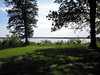
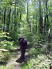
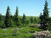
 The Dolly Sods tract in West Virginia is special to a lot of naturalists and other fans of the outdoors. Geologically, it’s on the eastern edge of the Appalachian Plateau province, where the Ridge and Valley province gives way to it. At an elevation of about 4000 feet, it’s just west of the eastern Continental Divide, hence part of the Ohio River watershed. The nutrient-poor, poorly drained soils support plant communities of sphagnum glades, blueberry heath barrens, and grassy balds—and that means some animal specialities can be found, too. Part of the Monongahela National Forest, parts of the area received wilderness designation in 1975. Since so many others have written about it, I was overdue for my first visit to the place.
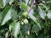
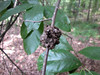
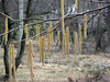
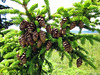 The local spruce is Picea rubens. The tall, isolated trees here show the effect of growing in an environment where the wind is always blowing from the west: there’s no foliage on that side of the tree. I found cones only at the tops of trees; fortunately, this stunted example along the Rocky Ridge Trail has matured at only six feet in height, so that I could get a snap of the cones from eye level.
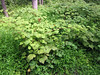
 Any hike when you get to walk through a big patch of Mountain Laurel (Kalmia latifolia) in bloom is a good hike.
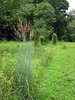
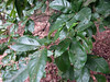
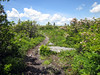
I saw a few small blueberries coming into ripeness; heard (and briefly saw) Black-throated Green Warbler (Dendroica virens) (actually, what I saw mght have been a Townsend’s); found lots of a cinquefoil that Wikipedia identifies as Three-toothed Cinquefoil (Sibbaldiopsis tridentata). As I walked on, I saw more laurel, more blueberries, more cinquefoil—a typical pattern of lower diversity under these extreme conditions.
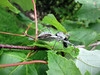
 The most common butterfly that I saw is dependent on blueberries. This Pink-edged Sulphur (Colias interior) found my gear an irresistible place to hang out for a while. And perhaps to spread some hormones about; I suspect this is a female, because a more strongly patterned male was pestering her.
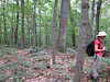
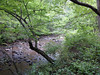
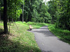
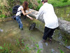
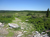
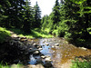 The Bear Rocks Trail is the “oh, let’s do the longer 10 mile loop” trail. Well-marked, a fun little stream to cross. The saddle you drop into before rising to meet the Raven Ridge Trail feels like walking into Brigadoon.
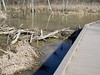
 Even a boardwalk over the wetter patches. This trail leaves you wondering about what all the fuss is about following trails in this wilderness, and about the quality of the Forest Service’s maps.
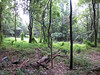
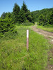
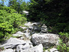 The Rocky Ridge Trail, on the west side of the tract, isn’t so clearly marked, at least not officially. The informal cairns (not quite to Boy Scout standards) keep you on the path.
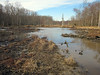
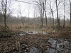
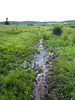 The Dobbin Grade Trail, a repurposed railroad grade, is the “dear lord, let’s just get home, OK?” trail. Poorly marked; after normal rains, there are substantial patches that are nothing but bog. Mind you, the guidebooks warn about this. The problem is that there’s nowhere for rain runoff to go, turning the sphagnum into a spongey gumbo. The trick I learned (too late) is this: if it looks wet, use your stick to find rock under it. If you don’t, you go in the goop over your boots.
And I had my opportunity to reroute my return over the Raven Ridge Trail. But I can be stubborn sometimes.
I suspect that the Forest Service is trying to exercise benign neglect on this useful trail that connects to many others. I think they would like to discourage hikers from using the track, since trail users are forced off trail and into the veg whenever a wet spot appears, disrupting the life of the bog.
A longer walk than I originally planned, seduced as I was by the easy going on the Bear Rocks Trail. There is some climbing, but I didn’t track the elevation change. 7:45 for 10.8 miles, with a generous lunch break and birding from time to time. Overreached myself a little bit, as I had nothing left in the tank for the last mile or two, and I dropped plans of further hiking for the next day.
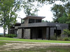
Note for next time: I used a chain motel back in Woodstock, Va. as my base camp for this trip. It’s a 2-plus-hour drive from Woodstock to the wilderness. Next time, I’d like to try one of the smart-looking cottages along route 55 in Petersburg, rented by the Smoke Hole Resort. From there, route 28/7 and the Forest Service roads into the wilderness is just five minutes away.
Update: There’s an orphaned article by Andy Hiltz about the area that has some useful information.
Update (8 May 2024): Andy Hiltz’s article, archived.
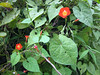 On the state road leading to her land, Catharine pointed out Red Morning-Glory, or Redstar (Ipomoea coccinea) growing in a hedge managed for butterflies. There seems to be some question as to whether Ipomoea is native to this part of the country.
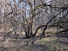
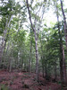 The bulk of the property is a Beech-Tuliptree forest, with some magnificent examples of Fagus grandifolia. Our group measured around one tree, computing a DBH of 110 cm. And with beeches come the parasitic Beechdrops (Epifagus virginiana)—plentiful here, but difficult to photograph with a point-and-shoot.
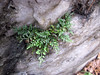
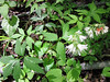
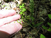
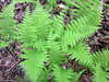
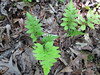
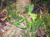 Our destination plant was Shining Clubmoss (Huperzia lucidula), found in one small clump at the base of a tree. This fern ally is kin to the more often-seen Lycopodium ground pines.